



Gifting Made Simple
Give the Gift of ChoiceClick below to purchase a Bramalea City Centre eGift Card that can be used at participating retailers at Bramalea City Centre.Purchase HereHome
Mapping The Silk Road And Beyond: 2,000 Years Of Exploring The East
Coles
Loading Inventory...
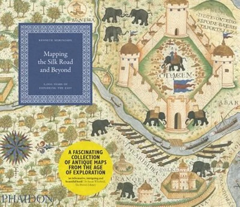
Mapping The Silk Road And Beyond: 2,000 Years Of Exploring The East in Brampton, ON
Current price: $35.00
Coles
Mapping The Silk Road And Beyond: 2,000 Years Of Exploring The East in Brampton, ON
Current price: $35.00
Loading Inventory...
Size: Paperback
*Product information and pricing may vary - to confirm current pricing, availability, shipping, and return information please contact Coles. In the event of a pricing discrepancy, the retailer's price will apply.
Today the world is focusing unprecedented attention on Asia and the Middle East - rediscovering a cultural, political, and geographical landscape that has fascinated and frustrated Westerners since the time of Alexander the Great.
Mapping the Silk Road and Beyond traces the history of the European age of exploration and its lasting effects on these regions through an extensive series of beautifully rendered and imaginative maps drawn by explorers, merchants, and colonial administrators of the time. The book focuses on both maritime exploration and overland discovery via the ancient Silk Road: a network of trading posts that encompassed China, Tibet, Pakistan, India, Kurdistan, Iraq, Ethiopia, Eritrea, and dozens of other places known in ancient times by fabled names, including Abyssinia, Malacca, Macassar, Siam, and Cathay.
The maps provide detailed visual keys to the fascinating history of Asia and the Middle East: altogether they illuminate a cast of historical figures ranging from great leaders (the Queen of Sheba, Mohammed the prophet, King Charles V) to legendary explorers (Marco Polo, Columbus, Magellan, Sir Francis Drake, Capt. James Cook) and influential cartographers.
Mapping the Silk Road and Beyond depicts over eighty maps organized in clear chronology - from Alexander the Great's map of the world, first created in 323 BC and reproduced in a sixteenth-century atlas, to maps from the nineteenth century by French and Dutch explorers that detail the growing interaction between Europeans and Eastern cultures. These maps represent the finest examples in existence in museums, libraries, and archives around the world, chosen because they depict the most important milestones in the mapping of Asia.
Today the world is focusing unprecedented attention on Asia and the Middle East - rediscovering a cultural, political, and geographical landscape that has fascinated and frustrated Westerners since the time of Alexander the Great.
Mapping the Silk Road and Beyond traces the history of the European age of exploration and its lasting effects on these regions through an extensive series of beautifully rendered and imaginative maps drawn by explorers, merchants, and colonial administrators of the time. The book focuses on both maritime exploration and overland discovery via the ancient Silk Road: a network of trading posts that encompassed China, Tibet, Pakistan, India, Kurdistan, Iraq, Ethiopia, Eritrea, and dozens of other places known in ancient times by fabled names, including Abyssinia, Malacca, Macassar, Siam, and Cathay.
The maps provide detailed visual keys to the fascinating history of Asia and the Middle East: altogether they illuminate a cast of historical figures ranging from great leaders (the Queen of Sheba, Mohammed the prophet, King Charles V) to legendary explorers (Marco Polo, Columbus, Magellan, Sir Francis Drake, Capt. James Cook) and influential cartographers.
Mapping the Silk Road and Beyond depicts over eighty maps organized in clear chronology - from Alexander the Great's map of the world, first created in 323 BC and reproduced in a sixteenth-century atlas, to maps from the nineteenth century by French and Dutch explorers that detail the growing interaction between Europeans and Eastern cultures. These maps represent the finest examples in existence in museums, libraries, and archives around the world, chosen because they depict the most important milestones in the mapping of Asia.
You May Also Like







Find at Bramalea City Centre in Brampton, ON
Visit at Bramalea City Centre in Brampton, ON